Climbing Mount Smolikas: Greece’s Second Highest Peak
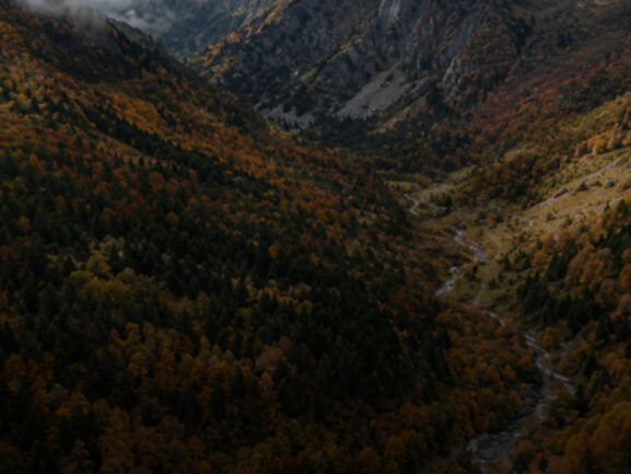
Deep in the Pindus mountains of northern Greece, Mount Smolikas stands at 2,637 metres — the second highest peak in the country, after Olympus. Yet compared to its more famous neighbour, Smolikas hiking is an experience defined by solitude. Here you will find vast alpine meadows, ancient beech forests, and one of the most extraordinary glacial lakes in the Balkans, with far fewer footprints than the trails to the north.
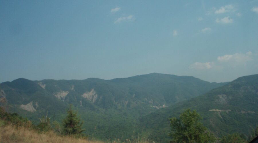
The mountain sits in the Epirus region, straddling the border of the Ioannina and Grevena regional units, within the protected landscape of the Northern Pindus National Park. It is wild, remote, and magnificently rewarding for those willing to make the journey.
About Mount Smolikas
Smolikas is the highest point of the Kamvounia ridge, part of the greater Pindus range that forms the spine of mainland Greece. The mountain is composed largely of ultramafic rocks — serpentinite and peridotite — which give the soil its distinctive reddish-orange hue and support a unique flora found nowhere else in Greece. Rare endemic plants cling to the scree slopes, and brown bears and wolves still roam the forests below the treeline.
The summit pyramid is steep and rocky, but the trails are well-worn and manageable for fit hikers with mountain experience. There is no technical climbing required — just good boots, good lungs, and a willingness to earn your views.
The Main Trail to the Summit
The most popular route for Smolikas hiking begins from the village of Kefalovryso (also called Agia Paraskevi), accessible from the town of Konitsa. From the trailhead at around 900m elevation, the path climbs steadily through mixed forest before breaking out into open alpine terrain at approximately 1,800m. The total ascent to the summit is around 1,700 vertical metres and takes 5 to 6 hours at a steady pace.
An alternative approach starts from the village of Pades on the eastern side, traversing high ridgelines with sweeping views across the Valia Kalda National Park. This route is slightly longer but offers dramatic panoramas of the surrounding Pindus peaks, including the twin summits of Tymfi (Gamila) to the south-west.
The trail is marked with red and yellow waymarks, though some sections across the upper scree are faint. A GPS track or experience in alpine navigation is strongly recommended.
The Drakolimni of Smolikas
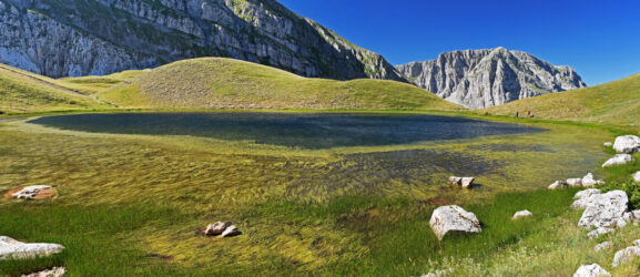
No trip to Smolikas is complete without visiting the Drakolimni — the Dragon Lake — nestled at around 2,150m on the eastern face of the mountain. This glacial lake, one of two Drakolimnis in the Pindus (the other sits on Mount Tymfi), is home to the Alpine Newt (Ichthyosaura alpestris), a small amphibian that thrives in these cold, clear waters. Legend holds that the lakes are guarded by dragons, and on a stormy afternoon with mist rolling off the surrounding crags, it is easy to believe.
Many hikers choose to camp beside the Drakolimni on a two-day itinerary, ascending to the summit on day one and descending via the lake on day two. The flat grassy banks make for an atmospheric overnight stop, and the silence after sunset is absolute.
When to Climb Smolikas
The best conditions for Smolikas hiking are from mid-June through September. Snow typically lingers on the upper slopes until late May or even early June, and the high trails can be icy and hazardous before the snowmelt is complete. July and August bring stable weather, warm days, and the meadows in full bloom with wildflowers. September is perhaps the finest month of all: the crowds (such as they are) thin out, the light turns golden, and the air is crisp and clear.
Avoid hiking in thunderstorms, which build quickly over the Pindus in summer afternoons. An early start — leaving the trailhead by 7am — ensures you reach the summit before the clouds roll in.
What to Bring
Given the remote nature of the mountain, preparation is essential. Pack at least 2.5 litres of water per person (the Drakolimni is drinkable with treatment, but there are few water sources on the upper trail), high-energy food for a full day, and warm layers even in summer — the summit temperature can be 10–15°C cooler than the valley. Sunscreen, a headtorch, and a basic first aid kit round out the essentials. Mobile signal is unreliable above the treeline, so a downloaded GPS map or paper topographic map is wise.
Guided Smolikas Hiking with Foxie
Smolikas is a mountain that rewards experience, and going with a knowledgeable local guide makes all the difference — not just for safety, but for the stories, the ecology, and the hidden details that transform a hard walk into an unforgettable experience. Foxie offers a guided ascent of the Κορυφή Σμόλικα, departing in late June with small groups and experienced mountain guides from the region.